")
")
")
")
Categories Books Books about the history of cartography Recueil des Plans du Roussillon, de Catalogne, des Chasteaux, Villages, Eglises, Chapelles & Maisons
Categories Books Books about the history of cartography Vistes panoràmiques, cartes militars i plànols urbanístics a Barcelona del segle XVI al XIX
Categories Books Books about the history of cartography Mapes i control del territori a Barcelona. Vuit estudis
Categories Books Books about the history of cartography Estudis sobre la cartografia de Barcelona, del segle XVIII al XXI:Els mapes d'una ciutat en expansió
Categories Books Books about the history of cartography Aproximacions a la història de la cartografia de Barcelona
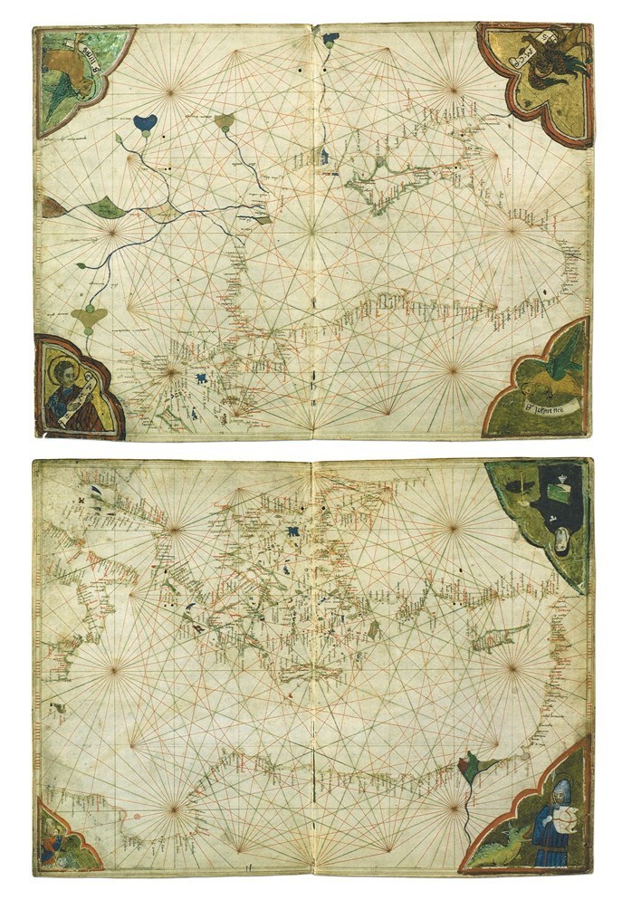
Categories Books Books about the history of cartography Els portolans a l'edat mitjana. Una contribució a la història de la cartografia i la nàutica
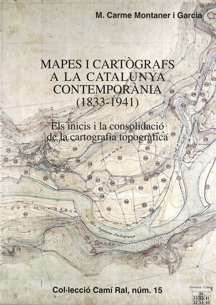
Categories Books Books about the history of cartography Mapes i cartògrafs a la Catalunya contemporània (1833-1941)
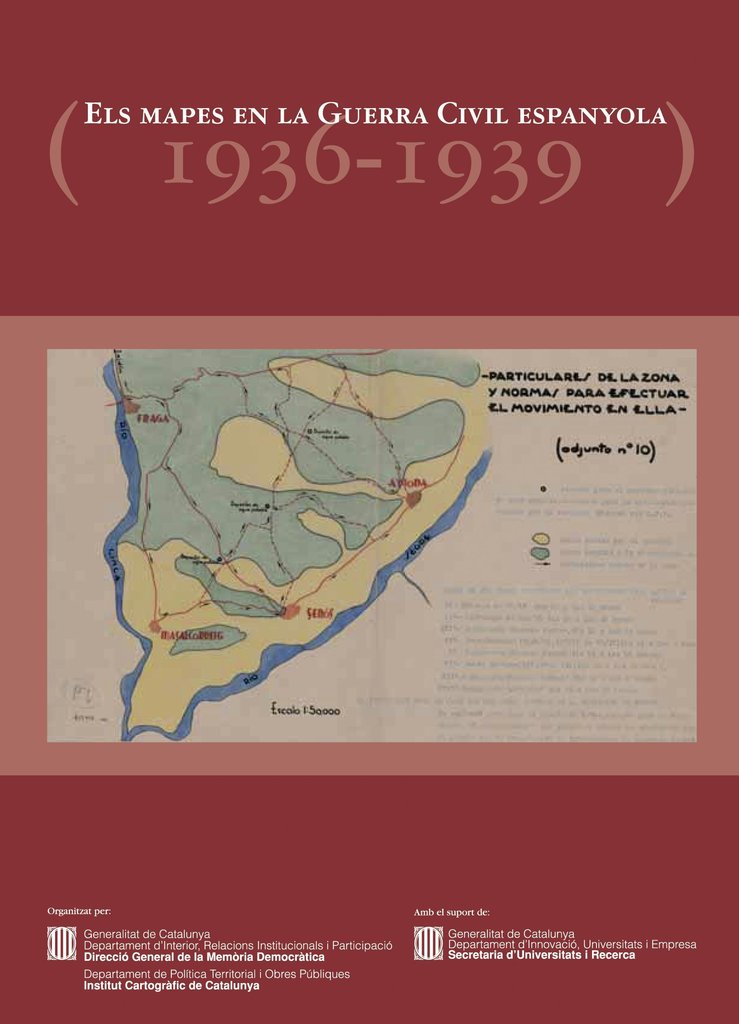
Categories Books Books about the history of cartography Els mapes en la Guerra Civil espanyola (1936-1939)
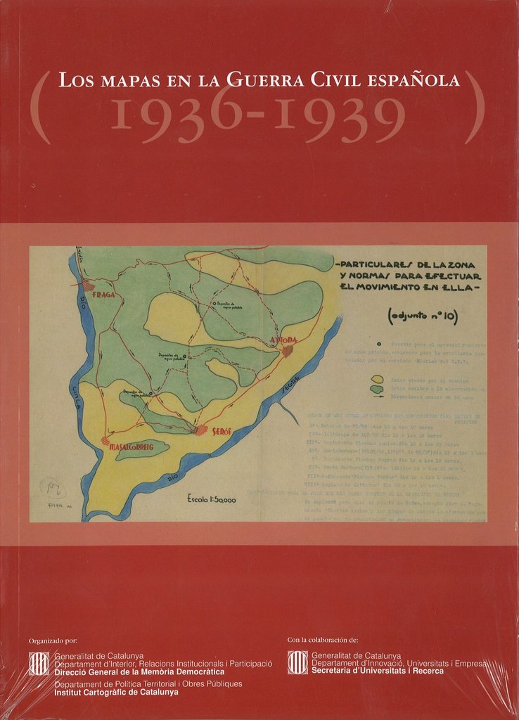
Categories Books Books about the history of cartography Los mapas en la Guerra Civil española (1936-1939)
Categories Books Books about the history of cartography Els mapes del territori de Catalunya durant dos-cents anys, 1600-1800
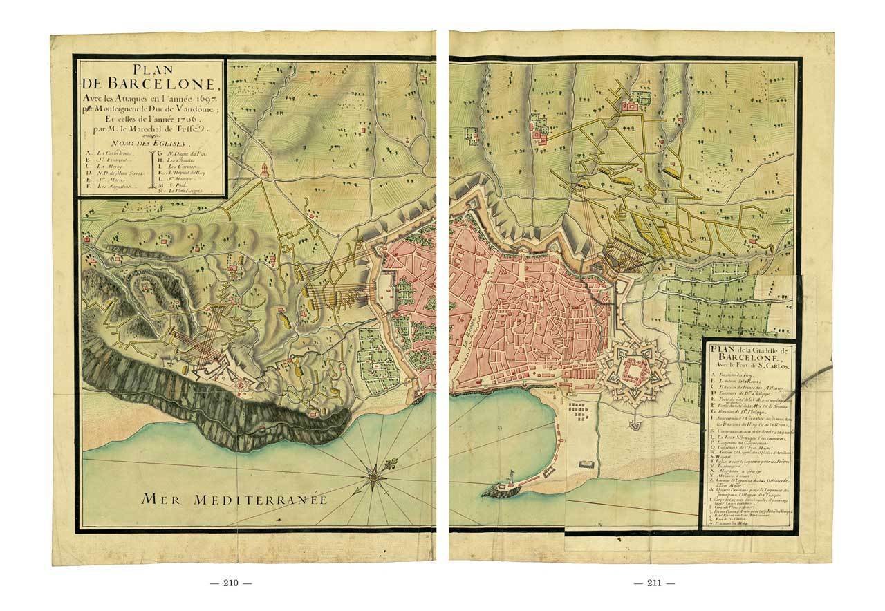
Recueil des Plans du Roussillon, de Catalogne, des Chasteaux, Villages, Eglises, Chapelles & Maisons
In stock
Available delivery methods: Registered mail, Registered mail, Registered mail
We also recommend
Antoon van den Wijngaerde, pintor de ciutats i de fets d'armes a l'Europa del Cinc-cents
23.11 €
/ unit(s)
Delivery weight: 1,006 g
|
De Mercator a Blaeu. España y la edad de oro de la cartografía en las 17 provincias de Países Bajos
20.19 €
/ unit(s)
Delivery weight: 872 g
|
De Mercator a Blaeu. Espanya i l'Edat d'Or de la cartografia a les 17 províncies dels Països Baixos
20.19 €
/ unit(s)
Delivery weight: 806 g
|
El mapa com a eina de govern: Centenari de la creació dels serveis geogràfic i geològic de Catalunya
0.00 €
/ unit(s)
Delivery weight: 445 g
|
Els mapes del territori de Catalunya durant dos-cents anys, 1600-1800
34.62 €
/ unit(s)
Delivery weight: 1,250 g
|
 |
 |
Cartografia de Catalunya: Catàleg general de la Cartoteca de Catalunya
15.38 €
/ unit(s)
Delivery weight: 1,146 g
|
 |
Customers who bought this product also bought
")
Delivery weight: 556 g
|

Vistes panoràmiques, cartes militars i plànols urbanístics a Barcelona del segle XVI al XIX
33.65 €
/ unit(s)
Delivery weight: 950 g
|
Browse this category: Books about the history of cartography
Vistes panoràmiques, cartes militars i plànols urbanístics a Barcelona del segle XVI al XIX
Latest copies available
Available delivery methods: Registered mail, Registered mail, Registered mail
1st edition. 2020
Ramon Grau / Carme Montaner (editors)
Download the digital version in PDF 
We also recommend
 |
Estudis sobre la cartografia de Barcelona, del segle XVIII al XXI:Els mapes d'una ciutat en expansió
33.65 €
/ unit(s)
Delivery weight: 816 g
|
 |
Customers who bought this product also bought

Recueil des Plans du Roussillon, de Catalogne, des Chasteaux, Villages, Eglises, Chapelles & Maisons
38.46 €
/ unit(s)
Delivery weight: 1,204 g
|
Browse this category: Books about the history of cartography
Mapes i control del territori a Barcelona. Vuit estudis
Latest copies available
Available delivery methods: Registered mail, Registered mail, Registered mail

1st edition. 2016
Ramon Grau / Carme Montaner (editors)
Download the digital version in PDF
We also recommend
|
|
Estudis sobre la cartografia de Barcelona, del segle XVIII al XXI:Els mapes d'una ciutat en expansió
33.65 €
/ unit(s)
Delivery weight: 816 g
|
Vistes panoràmiques, cartes militars i plànols urbanístics a Barcelona del segle XVI al XIX
33.65 €
/ unit(s)
Delivery weight: 950 g
|
Browse this category: Books about the history of cartography
Estudis sobre la cartografia de Barcelona, del segle XVIII al XXI:Els mapes d'una ciutat en expansió
Latest copies available
Available delivery methods: Registered mail, Registered mail, Registered mail
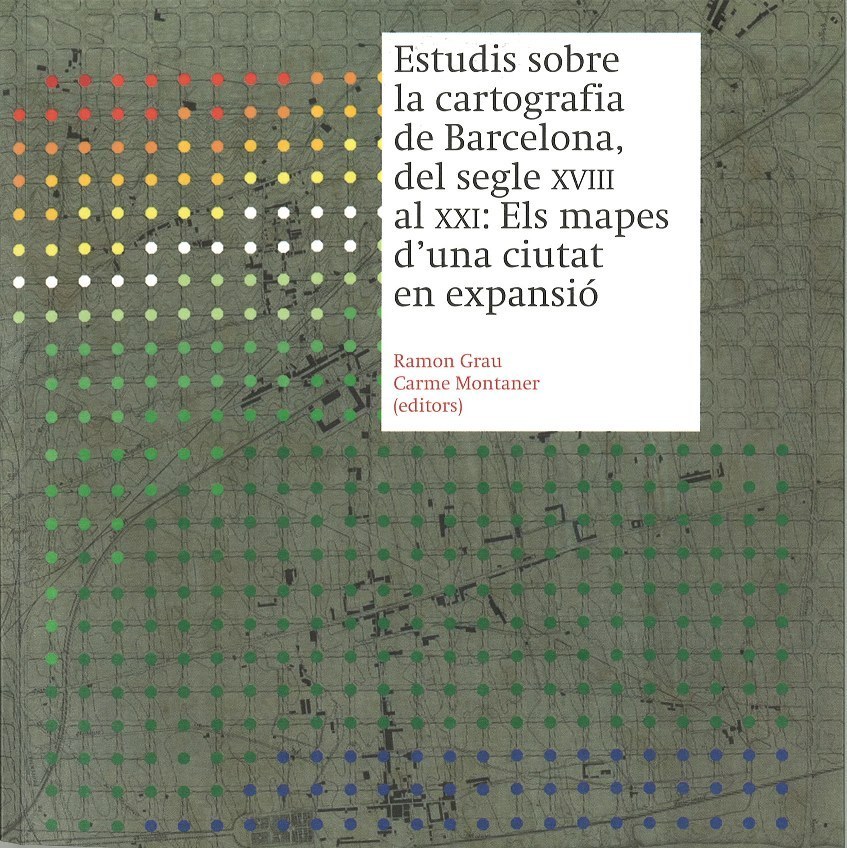
1st edition. Year 2014
Ramon Grau / Carme Montaner (publishers)
Download the digital version in PDF
We also recommend
|
|
Vistes panoràmiques, cartes militars i plànols urbanístics a Barcelona del segle XVI al XIX
33.65 €
/ unit(s)
Delivery weight: 950 g
|
|
Customers who bought this product also bought

Delivery weight: 1,470 g
|

Delivery weight: 2,136 g
|
Delivery weight: 740 g
|

Delivery weight: 3,763 g
|
")
Delivery weight: 1,216 g
|
Browse this category: Books about the history of cartography
Aproximacions a la història de la cartografia de Barcelona
Latest copies available
Available delivery methods: Registered mail, Registered mail, Registered mail
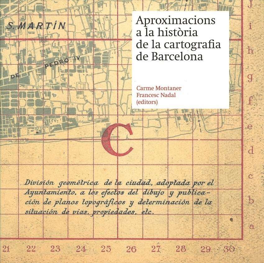
1st edition. Year 2010
Carme Montaner / Francesc Nadal (publishers)
Download the digital version in PDF
We also recommend
|
Vistes panoràmiques, cartes militars i plànols urbanístics a Barcelona del segle XVI al XIX
33.65 €
/ unit(s)
Delivery weight: 950 g
|
Customers who bought this product also bought
|
Delivery weight: 1,470 g
|
Delivery weight: 2,136 g
|
Delivery weight: 3,763 g
|
|
Delivery weight: 1,216 g
|
Estudis sobre la cartografia de Barcelona, del segle XVIII al XXI:Els mapes d'una ciutat en expansió
33.65 €
/ unit(s)
Delivery weight: 816 g
|
Browse this category: Books about the history of cartography
Els portolans a l'edat mitjana. Una contribució a la història de la cartografia i la nàutica
Latest copies available
Available delivery methods: Registered mail, Registered mail, Registered mail
Customers who bought this product also bought

Delivery weight: 1,258 g
|
Browse this category: Books about the history of cartography
Mapes i cartògrafs a la Catalunya contemporània (1833-1941)
In stock
Available delivery methods: Registered mail, Registered mail, Registered mail
Customers who bought this product also bought
|
Delivery weight: 1,216 g
|
Recueil des Plans du Roussillon, de Catalogne, des Chasteaux, Villages, Eglises, Chapelles & Maisons
38.46 €
/ unit(s)
Delivery weight: 1,204 g
|
Browse this category: Books about the history of cartography
Els mapes en la Guerra Civil espanyola (1936-1939)
Latest copies available
Available delivery methods: Registered mail, Registered mail, Registered mail
Exhibition catalog (January-March 2007)
Year 2007
Collection Catalogs of the Institut Cartogràfic i Geològic de Catalunya. Issue 9
Download the digital version in PDF
We also recommend
|
Recueil des Plans du Roussillon, de Catalogne, des Chasteaux, Villages, Eglises, Chapelles & Maisons
38.46 €
/ unit(s)
Delivery weight: 1,204 g
|
Cartografia de Catalunya: Catàleg general de la Cartoteca de Catalunya
15.38 €
/ unit(s)
Delivery weight: 1,146 g
|
Customers who bought this product also bought
|
Delivery weight: 1,146 g
|
Browse this category: Books about the history of cartography
Los mapas en la Guerra Civil española (1936-1939)
In stock
Available delivery methods: Registered mail, Registered mail, Registered mail
Exhibition catalog (January-March 2007)
Year 2007
Collection Catalogs of the Institut Cartogràfic i Geològic de Catalunya. Issue 10
Download the digital version in PDF
We also recommend
|
Recueil des Plans du Roussillon, de Catalogne, des Chasteaux, Villages, Eglises, Chapelles & Maisons
38.46 €
/ unit(s)
Delivery weight: 1,204 g
|
Cartografia de Catalunya: Catàleg general de la Cartoteca de Catalunya
15.38 €
/ unit(s)
Delivery weight: 1,146 g
|
Browse this category: Books about the history of cartography
Els mapes del territori de Catalunya durant dos-cents anys, 1600-1800
Latest copies available
Available delivery methods: Registered mail, Registered mail, Registered mail
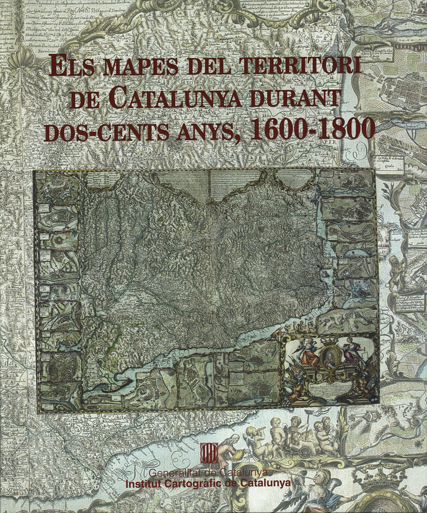
Catalog of the exhibition Els mapes del territori de Catalunya durant dos-cents anys, 1600-1800, Territory, organized by the Institut Cartogràfic de Catalunya on the occasion of the XXII International Congress of the Association Internationale de Bibliophilie (in Catalan language)
Year 2001
Collection Catalogs of the Institut Cartogràfic i Geològic de Catalunya. Issue 8
Download the digital version in PDF
We also recommend
|
Recueil des Plans du Roussillon, de Catalogne, des Chasteaux, Villages, Eglises, Chapelles & Maisons
38.46 €
/ unit(s)
Delivery weight: 1,204 g
|
Cartografia de Catalunya: Catàleg general de la Cartoteca de Catalunya
15.38 €
/ unit(s)
Delivery weight: 1,146 g
|
Customers who bought this product also bought
|
De Mercator a Blaeu. Espanya i l'Edat d'Or de la cartografia a les 17 províncies dels Països Baixos
20.19 €
/ unit(s)
Delivery weight: 806 g
|
Browse this category: Books about the history of cartography